Proposals
Our vision for Thundersley
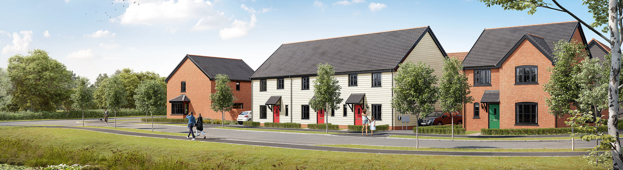
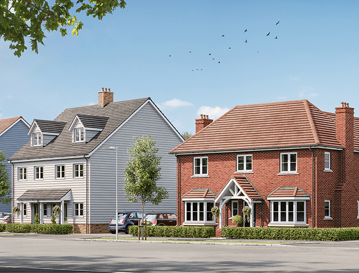
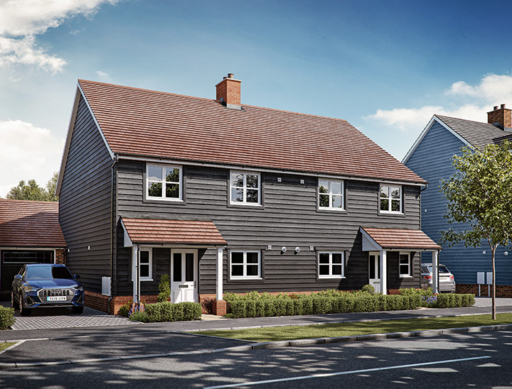
Our initial proposal was for 86 homes, however following engagement with the Council and ongoing technical assessments which considers the site and the local area, the proposal now seeks to deliver up to 70 high-quality sustainable homes. We believe the revised proposal would create a better place to live, work and play in Thundersley.
The design of the development has been informed by the character of the surrounding area, which includes a mix of modern and traditional homes. This will help ensure the new homes sit comfortably within the existing neighbourhood.
Up to 50% of the homes will be affordable, with a mix of sizes and tenures such as affordable rent, shared ownership and First Homes. These homes will be spread across the site and designed to look the same as other homes, helping to create a balanced and inclusive community.
We will continue to work with Castle Point Borough Council and other stakeholders as the proposals are developed further.
Key features
Designed to meet the needs of the local community
- A mix of up to 70 new homes – much needed locally.
- Up to 50% for either shared ownership or affordable rent.
- Sustainable location with good links to local services.
- Enhancement of green infrastructure and wildlife sites.

The site
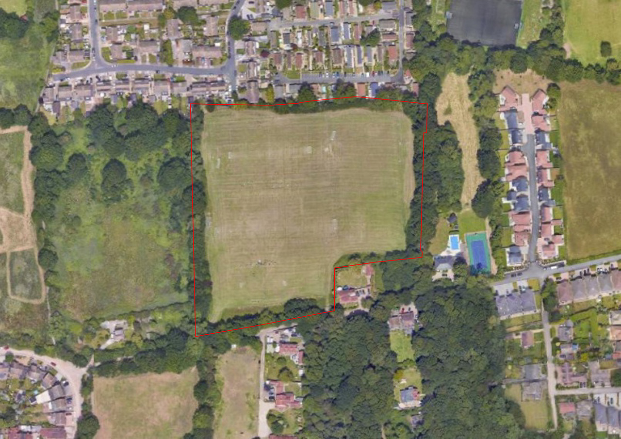
Site location
The site is located within Thundersley, close to existing homes and a range of local services and facilities.
There are shops, schools, healthcare facilities and community services within walking distance, including those along Hart Road and within Thundersley centre.
The site is also well served by public transport. Bus stops nearby provide regular services to Basildon, Rayleigh, Southend and Canvey Island, while rail stations at South Benfleet and Rayleigh offer connections to London and beyond.
This means future residents will be able to access day-to-day services and transport options easily, helping to reduce the need to travel by car.

 Site boundary
 Housing parcels
 Housing frontages
 Public open space
 Central Local Area of Play (LAP)
 Informal play areas within green space
 Tree planting
 Balancing ponds
 Central square
 Shared surfaces / driveways
 Footpaths forming part of circular route
 Landscape buffer / wildlife corridor
Planning context
Addressing a long-standing need for new homes
The Government has identified that Castle Point must deliver 686 new homes per year between 2026 and 2043, reflecting a long-standing shortfall in housing delivery. Over the past decade, delivery has averaged only around 99–100 homes per year, resulting in a significant shortage of housing, including affordable homes.
The Chase, Thundersley provides an opportunity to help address this need. The proposal for approximately 70 new homes on a sustainably located site would contribute towards increasing the supply of homes in the borough.
The site is currently underused and located within Thundersley. In the context of the borough’s need for new homes, it provides an opportunity to deliver housing in a well-connected location.
As this is an outline planning application, the current stage focuses on the principle of development and site access. Further details, such as the final layout, appearance and landscaping, will be developed later through a separate stage known as a Reserved Matters application.
The planning application will be considered by Castle Point Borough Council, who will review technical reports and consultation responses before making a decision. Local residents will also have the opportunity to comment as part of this process.
Landscaping plan
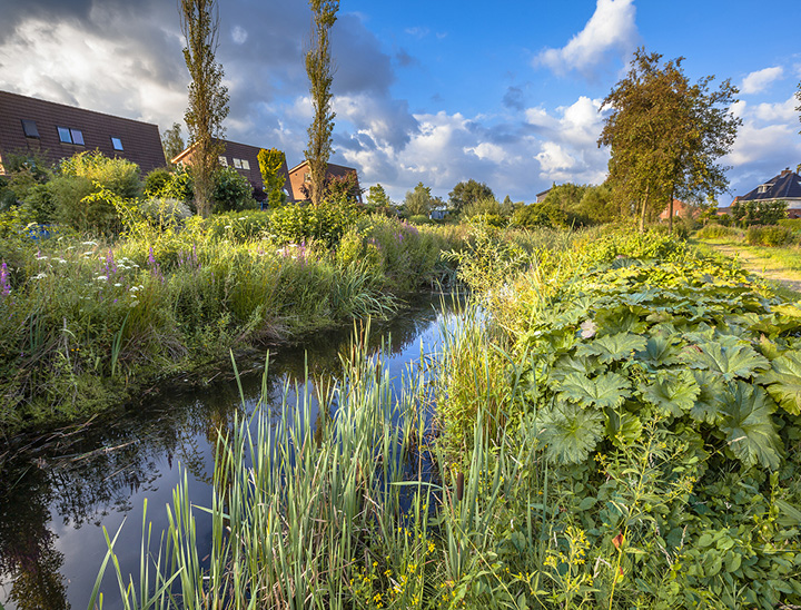
A landscape-led approach
Landscape plays an important role in the design of the development. Existing trees and hedgerows will be retained where possible, with new planting added throughout the site to create green spaces and enhance the appearance of the area.
New landscaping will help the development fit in with its surroundings and support local wildlife. The design also takes account of nearby Local Wildlife Sites, with planting and green space used to provide a suitable buffer and protect these areas.
Our landscape strategy offers ample opportunity to increase wildlife on site which will result in a biodiversity net gain.
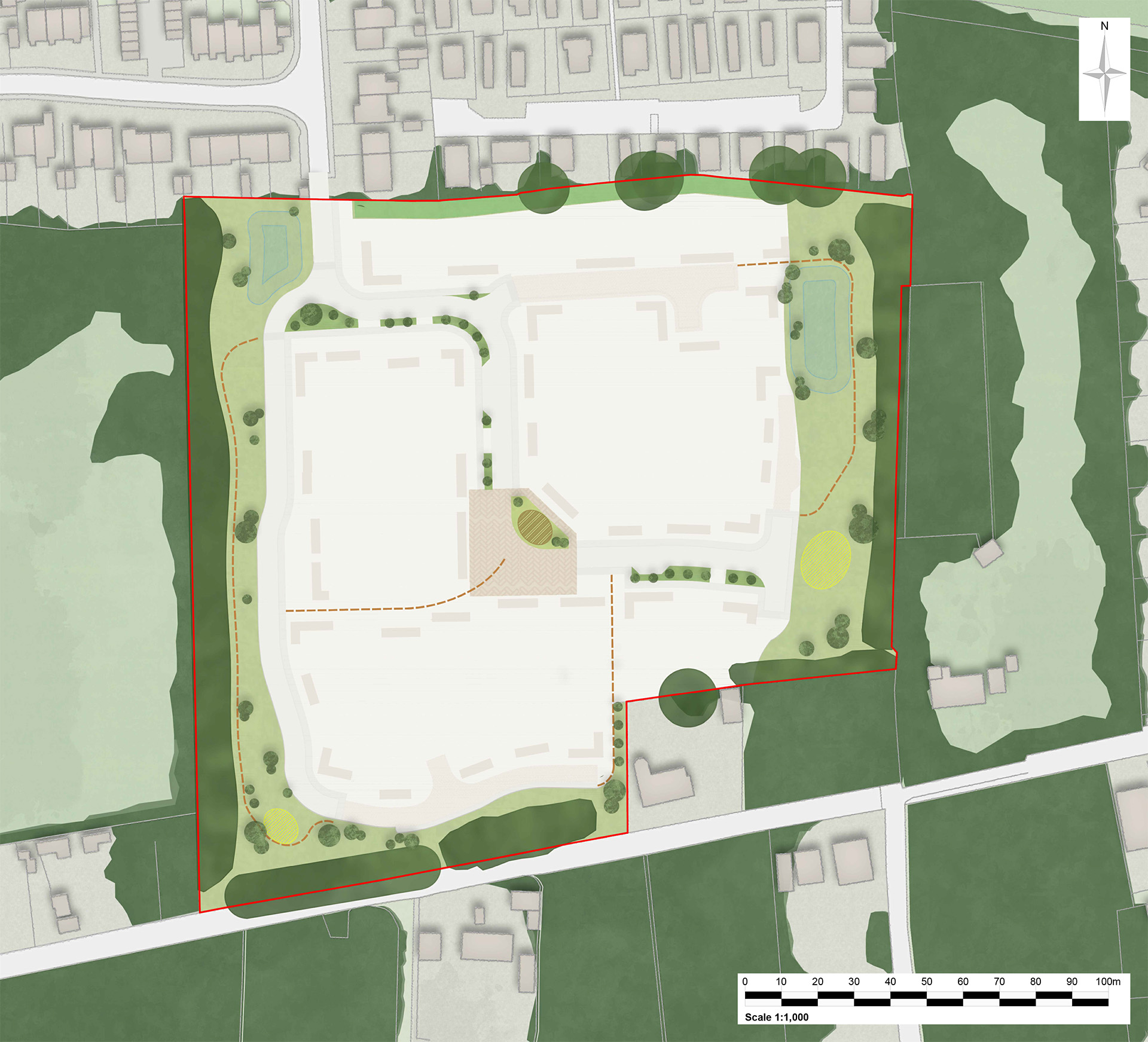
 Site boundary
 Public open space
 Existing trees / hedgerow
 Balancing pond
 Landscape buffer / wildlife corridor
 Central square with play area
 Informal play areas
 Main street verges
 Footpaths forming part of circular route
 Tree planting
Access plan
A well-connected location
The proposals have been designed to support safe and convenient movement around the site. Access for vehicles will be from The Rundels, providing a clear and direct route into the development.
As part of the planning process, detailed transport assessments will be carried out to understand how the development may affect local roads and traffic levels. These assessments will be reviewed by Essex County Council as the Highways Authority, and any necessary improvements will be identified and secured as part of the application to ensure the local road network continues to operate safely and efficiently.
The layout has been planned to create a safe and comfortable environment, with simple, easy-to-use routes and a well-connected neighbourhood.

 Site boundary
 Access point
 Main street
 Footways
 Shared surfaces / driveways
 Central square
 Other footpaths
Drainage strategies
Drainage across the site
The proposals include measures to manage rainwater in a clear and effective way.
Surface water will be managed through sustainable drainage systems (SuDS), which are designed as part of the layout and open spaces.
These features are designed to slow the flow of water, store it on site and release it at a controlled rate, helping to reduce the risk of flooding during heavy rainfall.
The drainage system will be designed to reflect the site’s natural characteristics, ensuring water is managed in a practical and efficient way across the development.
The SuDS features will also form part of the site’s green spaces, helping to create an attractive environment while supporting planting and wildlife.
Detailed drainage strategies will be prepared and agreed with the Council and relevant bodies as part of the planning application. This will ensure the development does not increase flood risk on site or in the surrounding area.